Travel Time Information Systems
The travel time is an indicator like no other for the road utilization. It reflects disturbances immediately as a reduced drive speed that results in a longer journey. A system to measure the travel time is in a position to determine the traffic statuses “free flow”, “tenacious traffic” or “congestion” directly and close to the human perception.
In a joint venture with the non-university research organisation AIT , EBE Solutions developed a standalone system that measures travel time on the basis of non-intrusive sensors (radar) and on the basis of the Bluetooth and WLAN signatures of mobile devices carried in the cars travelling along a certain route.
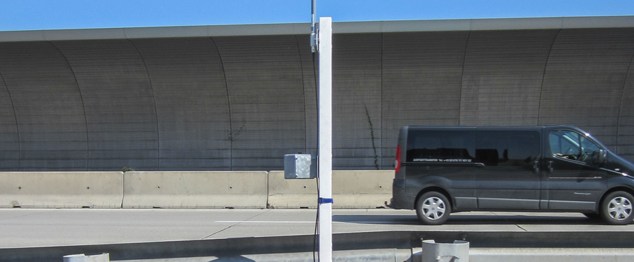
All outdoor components are set up as a small portable device that may be carried in passenger cars and deployed within minutes at the roadside. This allows a flexible ad-hoc monitoring the effects of stochastic events such as construction works or events on routes or road elements that are less supervised by standard traffic management.
Function
The idea behind the development was to create a system that is highly available, simply to operate – i.e. a rapid set-up and removal, stand-alone operation regarding energy supply and data connectivity. The operation purpose was supposed to cover motorways outside the well managed areas, hot-spot junctions of motorways with other roads, construction works that reduce the road capacity and encompasses changed lane geometry as well as events that effect the traffic status. The system consists of the (road side) sensor systems and a central application.
Mobile devices which are carried in cars that have Bluetooth and/or WLAN on, leave their signature in the measurement system’s receiver which is recorded. This signature does not allow to identify the user, so personal data are never collected. Though, the signature is unique enough to recognize the same handheld anytime later. The radar sensor delivers vehicle count data at the very measurement site and thus delivers an indication of the data sample quality, i.e. the ratio of users that carry handheld devices that are detected. Furthermore, a GPS-receiver is used to spot the site of the measurement equipment.The recorded data are transmitted to a central application in a wireless way.
The central application collects the gathered and transmitted data and calculates the travel times and traffic statuses along the observed roads segments. The central application is the source for further action, such as traveller information via variable message signs VMS.